
Finding Mount Pleasant Street Records
A Mount Pleasant street directory is an address sequence, not a list of neighbors. Charleston County’s property-card address search can return parcel rows along a road. Each row supplies a street number, TMS, and owner-on-tax-date lead. Open the individual card to distinguish the physical property address from the mailing address, collect the legal description and deed reference, then compare the parcel in the GIS viewer. The official sequence tracks public property evidence without assuming that an owner is the current occupant.
Once the parcel is identified, the ROD index and recorded document can place a transfer in time. CCPL’s qualifying reverse street lists can add a historic listed occupant or business. Town or County permit systems can establish a project chronology. Voter resources do not provide a verified public by-street roster, so they cannot fill the gap between owner and resident. A thorough street-by-street search states that boundary plainly.
- Enter the street number and name in County Property Record Cards and record the TMS and legal description.
- Open the same address in the Parcel Viewer, click its polygon, and use the Parcel ID link to compare the tax record.
- Use the recorded owner, book and page, or date as a lead in the Register of Deeds index.
- Follow grantor and grantee links backward only after matching the legal description, plat, or lot information.
- For a dated household clue, consult CCPL’s reverse street listings where the edition supports them.
Mount Pleasant Property Search Fields
The County’s property-card portal has separate address, owner, TMS, and sales-date routes. For a Mount Pleasant street directory search, street name is mandatory in address mode. The help instructions say to leave off the street type and spell an ordinal street name out before trying a numeral. A broad street query can be narrowed with a number. That small formatting rule is especially useful when an otherwise valid road fails to return a result.
| County search field | Mount Pleasant street use |
|---|---|
| Street number | Optional narrowing for a road or specific address. |
| Street name | Required in address mode; omit St., Ave., and similar types. |
| Last and first name | Owner-name route; omit hyphens, periods, and apostrophes as instructed. |
| Parcel ID / TMS | Ten digits, or ten digits plus A/B, without spaces or dashes. |
| Sales date | Separate transfer-date search, useful for a dated property lead. |
A situs address is the physical parcel location. A parcel is the tax-system land unit, while a plat is the recorded map or plan that can identify lots and subdivision layout.
The Charleston County Property Record Cards are the official entry point for those fields.
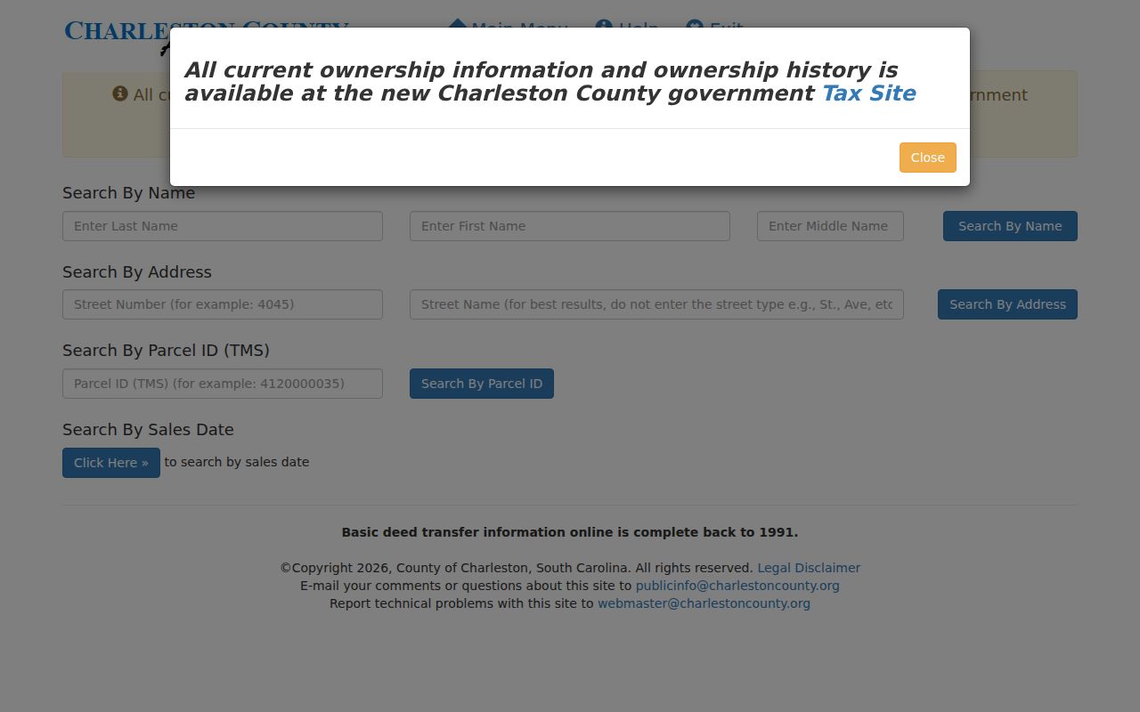
The separate search choices make a parcel, road, owner, and sale-date inquiry easier to distinguish before tracing the result further.
Mount Pleasant GIS Street Views
The Charleston County Parcel Viewer accepts parcel number, address, road or street name, and owner name in one search box. Zoom to the result, click the parcel polygon, and use the Parcel ID hyperlink to reach tax information. Its visible summary can include parcel ID, owner, acreage, plat book and page, deed book and page, and jurisdiction. The map is valuable for orienting an address, not for declaring an occupancy or a legal survey boundary.
Street and address points, parcels, boundaries, historic imagery, building-footprint years, Mount Pleasant address layers, zoning, future land use, and an urban-growth-boundary layer provide useful context. The viewer also has distance, area, coordinate, and feet-based buffer tools. Adjacent polygons can identify adjacent parcels and their tax-card owner fields. A buffer or label feature still needs a lawful research purpose and cannot convert County map data into a verified resident roster.
Mount Pleasant Address Record Sources
Several records can be searched by a Mount Pleasant address, but each answers a narrower question. The property card identifies parcel and tax fields. GIS shows mapped parcel context. The ROD connects recorded parties and instruments to a legal description. Permit systems can show an application or project sequence. A reverse directory may show a listed occupant or business in one historical edition. The street directory stays accurate when those roles remain separate.
| Address source | Custodian | Recorded connection | Access route |
|---|---|---|---|
| Property Record Card | Charleston County | TMS, owner, tax district, property and mailing fields | Address, owner, TMS, sales-date searches |
| Parcel Viewer | Charleston County GIS | Polygon, parcel summary, plat/deed references, layers | Map search and selected Parcel ID |
| Recorded instruments | Register of Deeds | Grantor, grantee, date, type, book/page | Index, image where available, counter, archive |
| Town or County permits | Town OPAL / County CSS | Project or application chronology, possible agent | Portal or custodian route |
| Reverse directories | CCPL South Carolina Room | Dated listed occupant or business | 1840 and 1890+ qualifying editions |
Basic County deed-transfer information is stated as complete online back to 1991, while the property-card display directs users to Card Image for earlier transfers. The street name opens the parcel record, but the TMS, legal description, and book-page reference are stronger links when a route changes, a parcel is replatted, or an old address is hard to recognize.
Mount Pleasant Deeds by Address
Use a Property Card’s legal description and deed reference before guessing from a name alone. The Register of Deeds document search reports deed and mortgage index data from 1978 and recorded images from 1997. It also offers name and date, type and date, book and page, tracer, and related modes. A grantor is the party conveying an interest; a grantee is the party receiving it. The recorded instrument, not an abbreviated property-card field, is the better source for the party roles and legal description.
When an online trace meets its coverage boundary, Charleston County reports physical access to recorded documents from 1719 through 1960 and film or microfiche from 1960 through 2005. Historic books and the counter are the appropriate continuation. A deed chain identifies recorded transfers. It does not show every person who occupied the address between conveyances.
Mount Pleasant Permit Chronology
Permits can add a date and project context to a Mount Pleasant street directory record. Town OPAL became the Town’s online permitting and application system on July 22, 2024, replacing Cityworks, BluePrince, and the prior Building Department system. The system supports planning, building, code-enforcement, and business-license processes, with registration for fuller application, tracking, and payment functions. A record may identify an owner, applicant, contractor, architect, or agent, but it is not an occupancy list.
The Town OPAL service page distinguishes its application path from FOIA requests, address requests, annexation petitions, short-term rentals, and other excluded items. Older permit research may need a Town records request or the pertinent planning file. County Citizen Self Service is the separate route for County-served areas, so jurisdiction should be checked first.

The OPAL screen reflects the newer Town application path, which matters when an address history crosses a permit-system change.
Mount Pleasant Street History Clues
Historic Mount Pleasant addresses can carry village or parish names that do not look like a current Town record. Town history identifies Greenwich, Hibben Ferry Tract, Mount Pleasant Plantation, Hilliardsville, Lucasville, and later Scanlonville. Greenwich and Mount Pleasant merged for incorporation in 1837, Hilliardsville was added in 1858, and Scanlonville was annexed in 1982. A historic label should be tested against plats, maps, legal descriptions, and directory locality headings.
No reviewed official source established a blanket Town-wide street-renumbering year. Avoid filling a missing address with an invented conversion. CCPL’s city directories supply a more careful historical handoff: ordinary directories before 1890 generally lack street indexes, except 1840 to 1841; reverse street coverage is available from 1890 onward. The City Directories page explains the collection itself.
Note: An old village name can be a valuable map or deed-search term, but it does not by itself establish a present parcel boundary.
Mount Pleasant Reverse Street Listings
Historic street research has a useful but limited CCPL route. The library’s historic-property guide identifies a street cross index for the 1840 directory and reverse street listings from 1890 onward. In a qualifying edition, find the address in the cross-reference and return to the name entry for related details such as an occupation abbreviation, business, or spouse notation when printed. A criss-cross directory is an address-to-name index, not a property record.
Ordinary directories before 1890 generally require a surname search, except the 1840 to 1841 cross index. Mount Pleasant may also appear in an East of the Cooper or other outlying-area section, particularly in later editions. A listed name is useful dated evidence, but the record should be paired with the parcel and deed trail before it is described as an address history.
Mount Pleasant Voter Tool Boundary
South Carolina’s MySCVotes tool provides the voter’s own registration, ballot, polling-place, and voting-history functions. The research did not verify a public street-by-street search of registered voters. The Charleston County Board of Voter Registration and Elections handles local election administration, precincts, and polling resources, while a specific records request follows the State Election Commission’s official written process and its current rules.
A missing online voter result is not proof that a person never lived on a Mount Pleasant street. A voter can request inactive status, after which the record becomes unavailable for online lookup even though the registration is not deleted. Keep election records within that limited context and rely on parcel, deed, and dated directory sources for the address chain.
The SEC’s FOIA request process asks for a defined subject, date range, custodian, and intended use. It says determinations are made in ten or twenty working days depending on record age. The state candidate toolkit describes a voter-list file with fields such as name, address, registration number, registration date, county, precinct, voting districts, and participation history, while also stating that a purchaser must be a registered South Carolina voter. That regulated-file description is not permission to turn the material into a Mount Pleasant street directory.
Mount Pleasant Street Search Limits
A Mount Pleasant street directory cannot establish every household member, private contact detail, driver record, utility customer, or protected voter information. The property-card owner field can differ from the mailing address and neither field is a census of occupants. MySCVotes is a voter self-service tool, not a public road-by-road list. DMV personal information is protected by the federal Driver’s Privacy Protection Act. Court, vital, and sealed records have separate limits.
South Carolina’s Family Privacy Protection Act and custodian-specific redaction rules add another reason to request only what is necessary. A street result can be useful for genealogy, a property question, estate research, or civic context. It should never be used to identify, contact, or target someone merely because a parcel is nearby.
When a record is incomplete, ask the office that created it about the lawful counter, copy, or redaction process. Do not fill the missing detail with an assumption from a map, mailing label, or directory entry.
Lawful use. Use address records for personal, lawful research and verify key facts with the relevant custodian. South Carolina law does not permit stalking, harassment, threats, or harm directed at another person.